Hindu Temple nearby Ganesh Mandir
Nepal
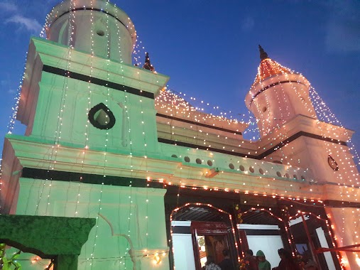
Hindu Temple nearby Ganesh Mandir
Ganesh Mandir
Kathmandu 44600, Nepal
contacts phone
:
+977
Latitude:
27.7135212
, Longitude:
85.3268087
larger map & directions
read more
nearest Hindu Temple
138 m
Nandikeshwar Mahadev
भगवती मार्ग, काठमाडौँ
Hindu Temple
read more
285 m
Shree Santoshi Mata Temple
Kathmandu
Hindu Temple
read more
354 m
Shree Laxminarayan Temple
हात्तीसार
Hindu Temple
read more
409 m
Ganesh temple
Pashupati Road, Kathmandu
Hindu Temple
read more
413 m
Kumari Sthan
Hattisar
Hindu Temple
read more
500 m
Pasupatinath Temple
Unnamed Road, Kathmandu
Hindu Temple
read more
557 m
Shree Sathya Sai Centre
Lal Durbar Marg, Kathmandu
Hindu Temple
read more
766 m
Narayan Temple
Kathmandu
Hindu Temple
read more
827 m
Lakshmi Pasi ajima
तीनधारा मार्ग, काठमाडौँ
Hindu Temple
read more
834 m
Ajima Temple
Teendhara Marg, Kathmandu
Hindu Temple
read more
1.552 km
Ram Mandir
Kathmandu
Hindu Temple
read more
1.555 km
Ram Mandir
Rudranagar Marg, Kathmandu
Hindu Temple
read more
1.557 km
Ramchandra Mandir
Gaushala Chwok Road, Kathmandu
Hindu Temple
read more
1.705 km
Shree Radha Krishna Temple
Kathmandu
Hindu Temple
read more
1.953 km
Chhaitya
Chittadhar Marg, Kathmandu
Hindu Temple
read more
1.993 km
Mandir
योगवीर सिंह मार्ग, Kathmandu
Hindu Temple
read more
2.017 km
Raktakali Temple
Chittadhar Marg, Kathmandu
Hindu Temple
read more
2.026 km
Nardevi Mandir
Gangalal Marg, Kathmandu
Hindu Temple
read more
2.026 km
Naradevi Temple
Naradevi, Kathmandu
Hindu Temple
read more
2.03 km
Nara Devi Temple/ Niyata Maru Ajima
Naradevi Bhajan Sthal, Gangalal Marg, Kathmandu
Hindu Temple
read more
2.034 km
NEPAL MANAV DHARMA SEWA SAMITI
Kathmandu
Hindu Temple
read more
2.05 km
Bhairav Mandir
Gangalal Marg, Kathmandu
Hindu Temple
read more
2.056 km
Ganesh Mandir
Gangalal Marg, Kathmandu
Hindu Temple
read more
2.061 km
Om Chandra Mauleshworaiya Temple
नरदेवी चोक, Gangalal Marg
Hindu Temple
read more
2.069 km
Swet Kaali Temple
Gangalal Marg, Kathmandu
Hindu Temple
read more
📑
all categories
Accounting
Administrative area level 1
Administrative area level 2
Airport
Amusement park
Aquarium
Art gallery
Atm
Bakery
Bank
Bar
Beauty salon
Bicycle store
Book store
Bowling alley
Bus station
Cafe
Campground
Car dealer
Car rental
Car repair
Car wash
Casino
Cemetery
Church
City hall
Clothing store
Colloquial area
Convenience store
Courthouse
Dentist
Department store
Doctor
Electrician
Electronics store
Embassy
Establishment
Finance
Fire station
Florist
Food
Funeral home
Furniture store
Gas station
General contractor
Grocery or supermarket
Gym
Hair care
Hardware store
Health
Hindu Temple
Home goods store
Hospital
Insurance agency
Jewelry store
Laundry
Lawyer
Library
Liquor store
Local government office
Locality
Locksmith
Lodging
Meal delivery
Meal takeaway
Mosque
Movie rental
Movie theater
Moving company
Museum
Natural feature
Neighborhood
Night club
Painter
Park
Parking
Pet store
Pharmacy
Physiotherapist
Place of worship
Plumber
Point of interest
Police
Post office
Premise
Real estate agency
Restaurant
Route
Rv park, camping
School
Shoe store
Shopping mall
Spa
Stadium
Storage
Store
Subpremise
Supermarket
Synagogue
Taxi stand
Train station
Transit station
Travel agency
University
Veterinary care
Zoo
administrative area level 3
sublocality level 1
↑